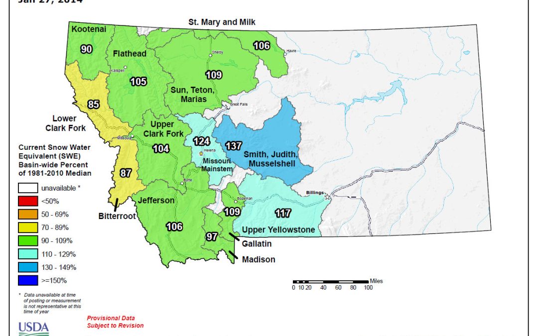
2014 Bitterroot Basin winter Snowpack information
This is the chart, see below for data on a map.
 NWCC – SNOTEL Snow Water Equivalent Update Graph – link to Graph
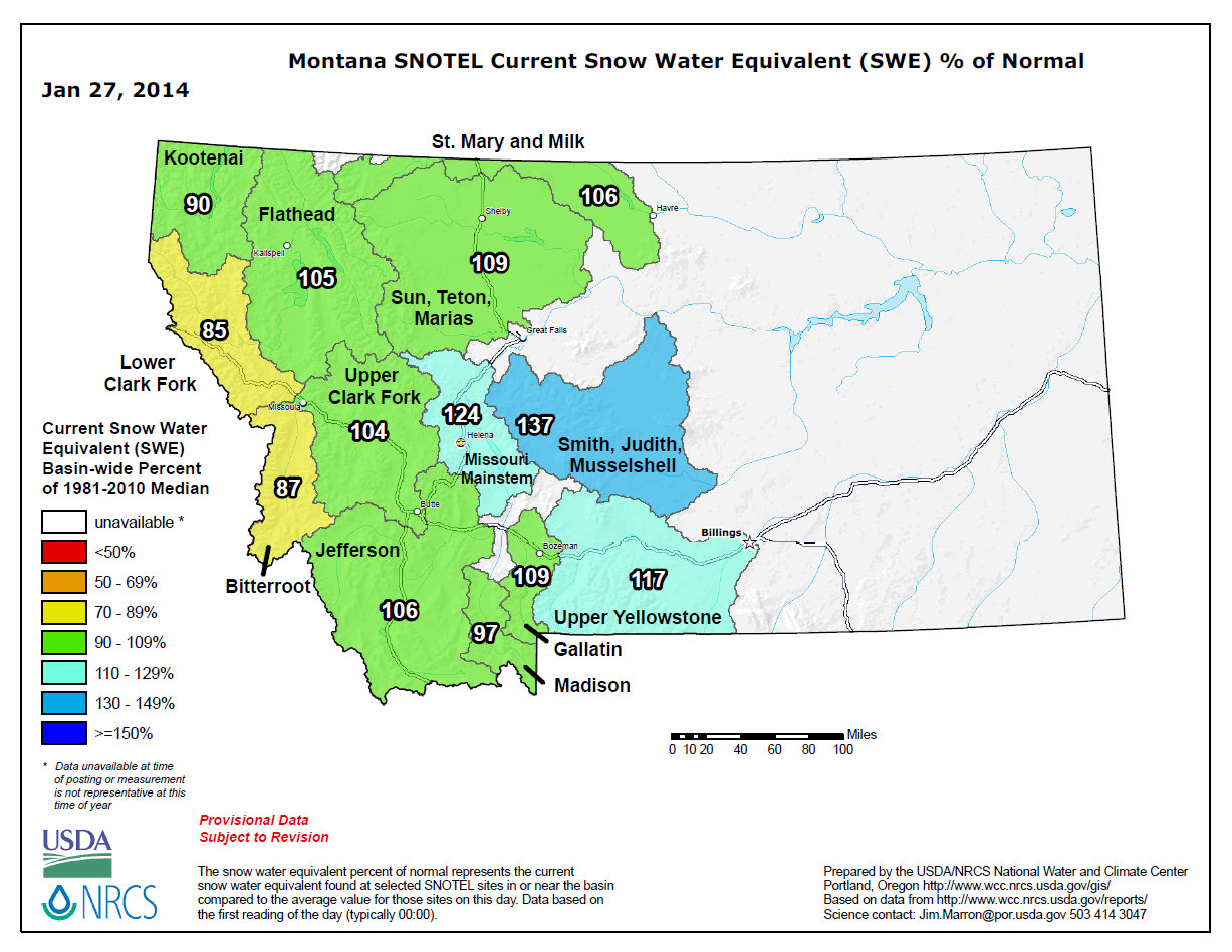
This is the chart, see below for data on a map.
NWCC – SNOTEL Snow Water Equivalent Update Graph – link to Graph

It is cold out there and windy, but a little snow now will help keep us fishing in the dryer summer months. We are doing the happy snow dance.
 |
| ftp://ftp.wcc.nrcs.usda.gov/data/water/wcs/gis/maps/mt_swepctnormal_update.pdf |
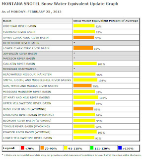
Snow pack in the Bitterroot is 82% of normal as of today, Feb 25, 2013. Right now, a winter snow storm just blew in and there is a white-out outside my office window. That is GREAT news!
Here are the tables showing the data. See the links below the photos for the NRCS site.

| http://www.wcc.nrcs.usda.gov/cgibin/snowup-graph.pl?state=MT |
 ftp://ftp.wcc.nrcs.usda.gov/data/water/wcs/gis/maps/mt_swepctnormal_update.pdf |
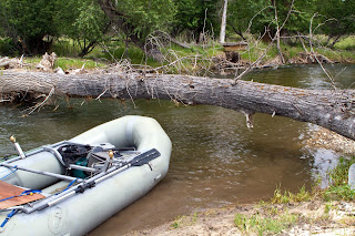
The river is big and fairly fast, but also pretty clear and fishing. Watch out for new hazards such as down Cottonwood trees. Below the charts is a slideshow of photos from the middle Bitterroot on June 11.


Bitterroot air temperatures have been in the high 80’s for the last three days and the snow melt is increasing the river flows. The air temperatures are supposed to drop in the next few days and rain is predicted next week. This will be interesting.
Here are some photos at Victor Crossing taken the afternoon of May 16.
Victor Crossing is about 5 miles upriver from the USGS water data gauge
at Bell Crossing and about 40 road miles down river (north) of the USGS
water data gauge at Darby. Below are photos of the river at Victor
Bridge, the charts for both gauges, and a snow pack map.


The Bitterroot had clarity on May 7 and still on May 8 – also terrific caddis hatches! But now the weather has been much warmer and the flows are stepping up. See the charts below.
 |
| Bitterroot River on May 7 north of Angler’s Roost |
 |
| Darby gauge station is upriver from Angler’s Roost – on May 7 flows at Darby were about 1900 CFS |
 |
| Bell Crossing gauge station is downriver from Angler’s Roost. On May 7 flows were about 3,000 CFS |
 |
| Still snow in the mountains!!! Bitterroot is 89 % of normal. |
Links to snowpack and USGS river flow gauge stations are in the right side bar.
