Tucker Crossing on the middle Bitterroot, looking southeast at the Sapphire Mountains
This month has been good for the snowpack. The Bitterroot Mountains have been receiving and storing snow at the higher elevations. There have been some teaser warm days, but the current week (third full week of March) will be cooler in temperatures and more snow is in the forecast.
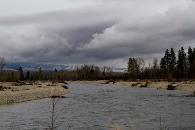
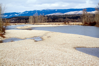
Here are photos of the Bitterroot near Bell Crossing on February 26, 2012. The cubic feet per second (CFS) was about 570. Temperature was in the low 30 degree range. Beautiful day. We like to give the fish a break in the winter while they are struggling to survive the cold, low water but I do like to chronicle the river in photos. Interesting to look back from year to year and compare winter conditions with spring, summer, and fall fishing observations. We love our rivers and all that lives in and on them. It is exciting to watch them as they change through the seasons.
All the river photos are taken from Bell Crossing Bridge looking north.
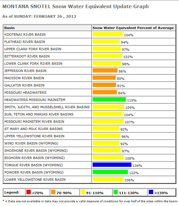
Finally after a pretty dry winter, we are getting more snow. Most of Montana was below 100% snow water equivalent, but that has changed and is forecasted to improve. A wet weather pattern is expected for early March. That is GREAT news for our rivers.Click the image for a larger view.
These photos are from Tuesday, May 17 at 5:00 pm. The Bitterroot dropped from 11,300 cfs to 10,300 cfs overnight (measured 7:00 am May 18) but day temps are predicted to be 68 degrees and scattered rain. We will see what that does to the levels.
There is room at Victor Crossing for more flow, but how much more? See Wapiti Waters Stream flow links to access USGS data for stream flows in our western Montana rivers.
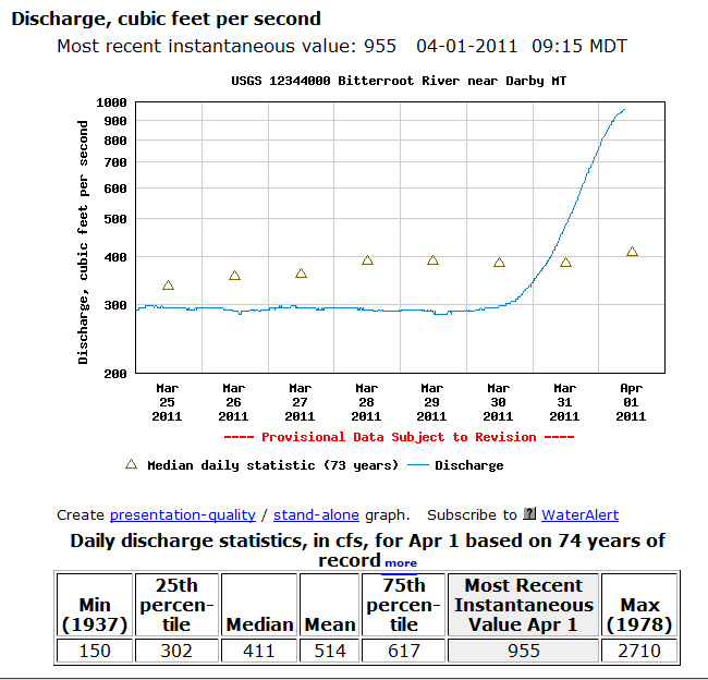
The Bitterroot River water flow near Darby has tripled in cubic feet per second (cfs). According to Jack, it is one of the fastest “bumps” up he has seen, which is why I say it has jumped up. The rain and warmer temperatures are bringing melted snow into the tributaries.
The Big Hole near Divide, Mont. has also come up from about 400 cfs two days ago to 647 cfs at the time of this writing.
The Clark Fork below Missoula has come up from a little over 3,000 cfs two days ago to 5,510 cfs. Rock Creek near Clinton was at about 250 cfs two days ago and is now 535 cfs.
The Blackfoot River near Bonner was a little over 1,000 cfs two days ago and is now 2,830 cfs.
Jack and I will heading down to the Darby area later today and I will try to get some photos along the way. Needless to say, the fishing won’t be happening.