Despite fairly warm temperatures, with no rain the Bitterroot River has been up, but with stable flows.
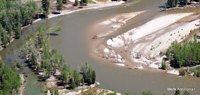
The slideshow shows Victor Crossing and it is looking very similar to my previous photos except for the new, large pine tree deposited in the middle just up (south) from the bridge. That will be fun to row around, not.
Jack added some captions to the slideshow. This coming week is going to be hot! The snowpack will be coming off in a hurry! Stay tuned.Here are some photos from Jack’s flight over the Bitterroot River on May 22, 2009. It is not in flood stage but definitely in run-off. The photos begin near Woodside, travel downstream (north) to MacClay’s near/north of Poker Joe, then turn and head back upstream (south) to finish near Darby.
The photo is of the Bitterroot River south of Victor Crossing. It was taken yesterday about 2:00 pm. Since then, it rose about 3000 cubic feet per second (CFS) – from approximately 10,000 to 13,000 CFS.
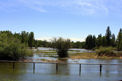
The National Weather Service has issued a flood warning, as of Tuesday afternoon, for the Bitterroot River in the Darby and Victor areas.
With tributaries rising on the heels warm weekend temperatures, officials with the National Weather Service say rapid snow melt has raised the likelihood of flooding.
The Bitterroot River was measured at 7.3 feet late Tuesday morning, with flood stage at 7.5 feet. The National Weather Service warns that flood waters can be expected to inundate several roads in Ravalli County.
The service issued a flood watch for the South Fork of the Clearwater River near Stites, Idaho. The South Fork of the river is expected to reach flood stages late Tuesday or Wednesday morning.
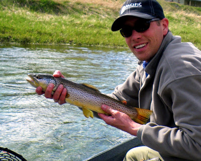
Jack fished the Missouri River with his son-in-law, Marshall Knick. It was coming up, the water was a bit cloudy but the managed to hook some fish. Jack caught this fish and Marshall is holding it. Josh Lauer has a photo of Marshall and the bigger brown that he caught. When Josh sends it to us, I will post it, too.
I had to include photos of Jack’s daughter, Hannah – of course married to Marshall, and their son’s Tristen and Tait!
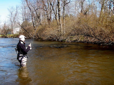
Dave Boomer and John Mikita on the Yellow Breeches yesterday. The water was a little high and cloudy.
I caught 2 brown trout, 13 inches and 10 inches. Both on size 16 Hendrickson dry fly.
I think Dave caught the fish he is playing in the picture on a Hendrickson.
I did not get a picture of Larry Clement who did the best. He caught 5 trout on a variety of flies including a white wooly bugger.
We all had a fun time. The weather was beautiful.
Jim
The middle photo is Larry on the Yellow Breeches in early May. He caught plenty of fish that day, too, I hear.
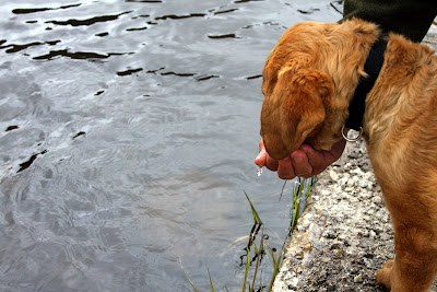
By the way, happy tenth birthday to your beloved dog, Tres.
Jim sent us the bottom photo and within it, in the photo on the bookcase, is Jim fishing the Bitterroot River in Montana. Here is the message he sent with it.
Does this dog have a hard life or what!
PS: Merle and Jack, if you zoom in on the leftmost picture on my book case you will see a picture Jack took of me and an 18 inch cutthroat that I caught on the Bitterroot. Great guide!
Keep sending us your fishing photos! We love hearing from you all.
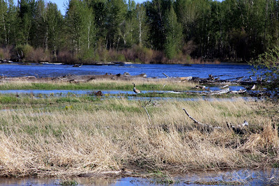
The photo to the right is from May 11 at Victor Crossing which is about the middle of the Bitterroot. You can see that it is fairly clear and big, but not bank-full or in the run-off stage.
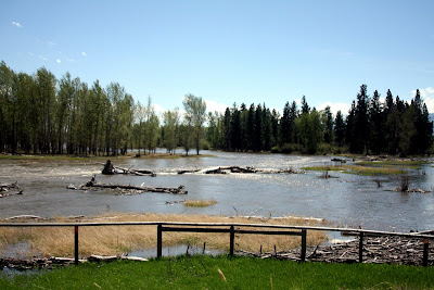
The weather this spring has been cool, cool, cool. The photo below was taken May 12. Yes, it was snowing. The snow-pack in the mountains is growing not shrinking.
Take a look at the weather widget to the left in the sidebar. It is forecasted to be 85 degrees this Sunday and Monday. That is going to be interesting!
Jack and Casey went to the Clearwater Chain of Lakes yesterday. It was cold and a bit windy but they caught some pike. No camera, so I can’t post any photos of that trip.
Tomorrow, Jack is going to the Missouri River to fish near Craig, Montana. It might still be cool and windy, but we will find out how the fishing is.
Stay tuned for a look at our rivers. I will be posting photos when I can.
See the sidebar for links to USGS water data and if you go near the rivers, please be very careful. The water is very, very cold, approximately 38 degrees.
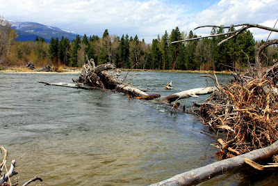
We drove through the Big Hole Valley a few days ago on our way to Bozeman and Billings. The slideshow below starts just east of Lost Trail Pass (it was snowing on our way over) and then visits the Big Hole River near Wisdom, Wise River, and Divide, Montana. Click the town names for more information on the Visit Montana site.
The river was big and fast, the weather was overcast and in the 45 degree range, but we saw a few boats with people fishing…not sure what the success rate was.
Jack is a permited Fly Fishing Outfitter for the Big Hole, has fished and guided on it for over 30 years, and loves that special high mountain valley. Click Wapiti Waters Big Hole web page for more information, including more links.
The owner of a Hamilton fly shop died in a rafting accident on the Bitterroot River Wednesday.
Richard “Dick” Galli, 72, drowned after the raft he was riding in overturned just south of Hamilton at about 2 p.m.
Ravalli County Sheriff Chris Hoffman said the three men launched their boat from a fishing access site at Anglers Roost.
Just downstream, they apparently hit a brush pile and the boat overturned, Hoffman said. It landed on a tree limb and the men were ejected….
…While the Bitterroot River isn’t running bank full, Hoffman said it has reached the point in the spring when floaters need to be very careful.“It’s always a fairly tricky river to float, but the danger increases in the spring,” Hoffman said. “We urge people to use extreme caution and maybe consider waiting to float until the river drops enough so they can see debris.”
 Despite fairly warm temperatures, with no rain the Bitterroot River has been up, but with stable flows.